WYEMANDOO CRITICAL MINERALS PROJECT
EXPLORATION STRATEGY
Aldoro’s exploration strategy has involved discriminating the numerous pegmatite-like feature, conducting a systematic rock chip sampling exercise and using analytical results to define pegmatites anomalous in lithium and rubidium for investigation by drilling.
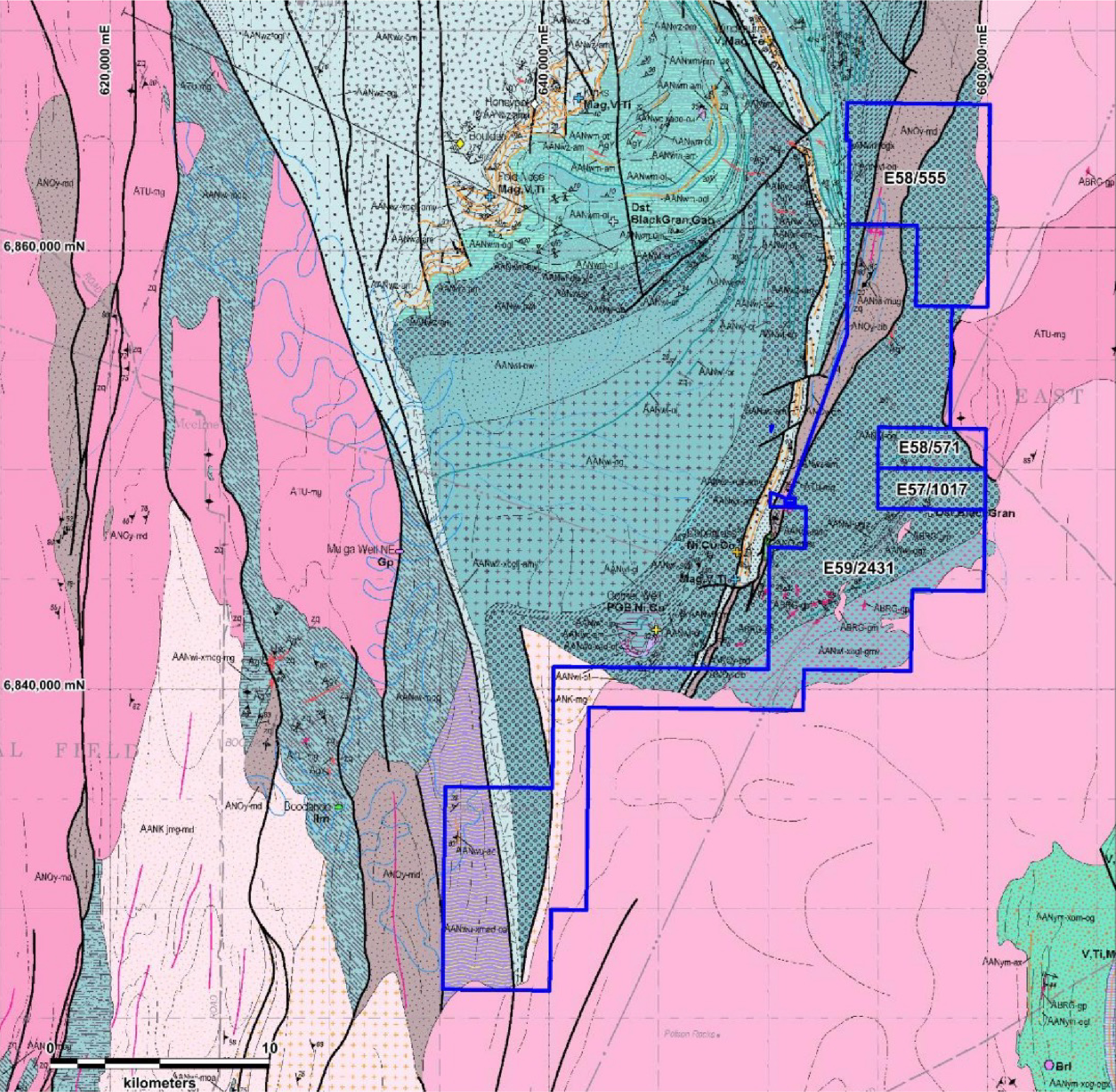
Satellite imagery was acquired over the licence and features that may represent dykes and plugs were delineated with over 1,000 such high albedo anomalies identified. The features display a range of orientations and morphologies, but general NE and antithetic NW oriented strikes were noted. These features generally were identified in the dominate metagabbros that form the southeastern margin of the Windimurra Complex. The area is dominated by geomorphic domes ringed by broad sheet wash or braided anastomosing drainage channels. The dyke-like features are preserved on the domes being more resistive to erosion, although they probably extend in the alluvium.
For the purposes of segregating the pegmatites clusters the domes have been adopted with some 79 separate domes identified across the corridor containing the intrusive-like features. A priority rating system for each of the Domes was based on the proximity to the parental granites with the highest rating (P1) along the sampled lepidolite pegmatites, a band in the central fairway, the P2 domes lie to west of the P1 domes and further away from the granites where fractionation within the pegmatites may increase. The P3 domes surround the P2 and P1 domes and P4 is assigned to those domes surrounding the P3 domes on the outer reaches of the corridor.
A rock chip sampling commenced in the higher rated domes (P1) with lepidolite bearing pegmatites with a strategy to be collect channel samples across the width of the dyke/sill at intervals of 30-40m along strike for analytical analysis.
The pXRF gun was used to help discriminate the of higher interest using Rb which should, by proxy, contain higher Li values (as Li is not available on pXRF machines). Rock chip samples consist of twin samples (analytical and representative) in the order of 2-3kg each for each sample location (GPS), description (including strike, width, dip, extent), pXRF reading and photograph taken. Sample planning is shown on Figure 2 with the dispersion falls within the pegmatite corridor (Fairway). The corridor is based on geological constraints.
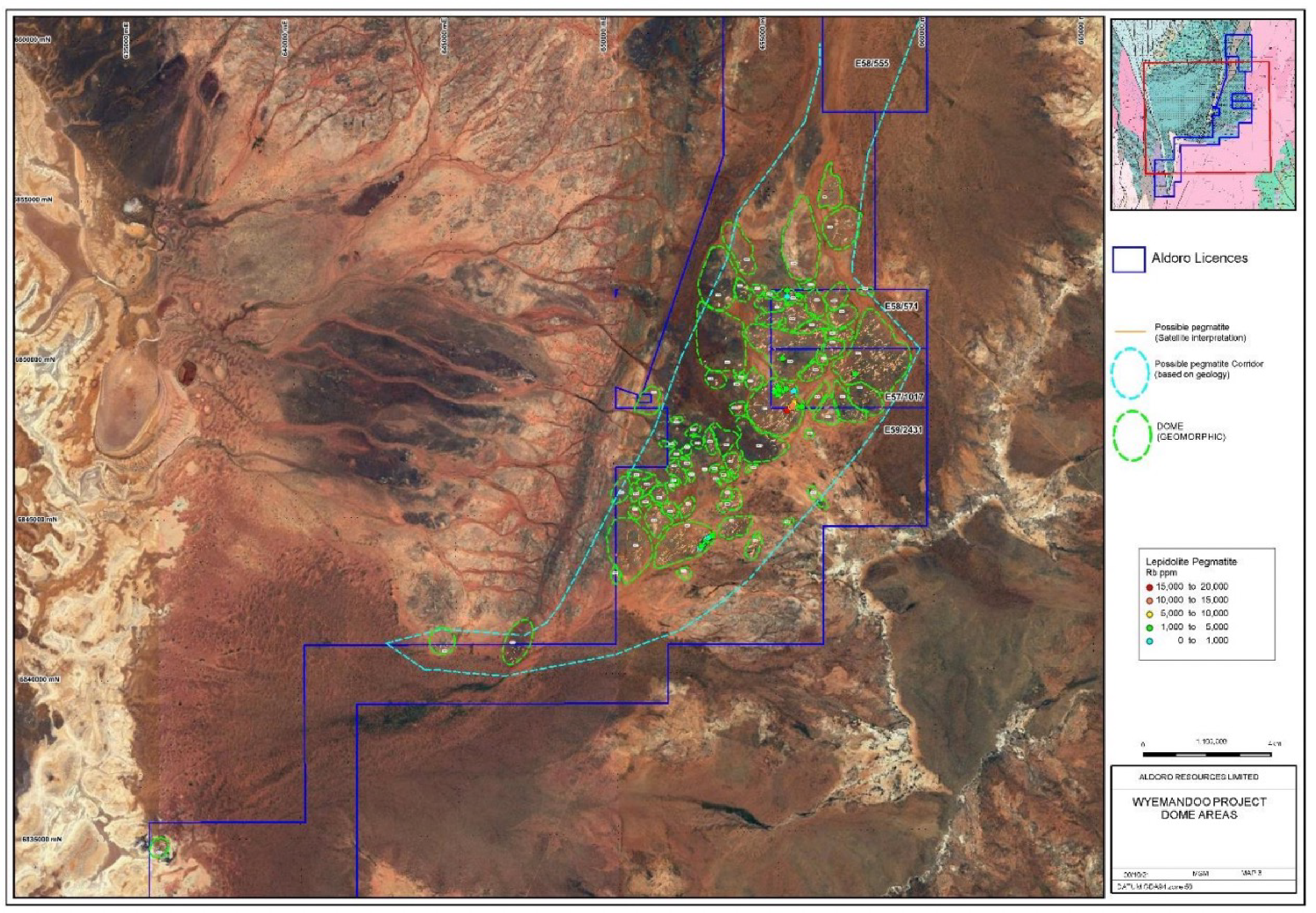
Figure 2: Geomorphic Domes and distribution of possible pegmatite across the interpreted pegmatite corridor
Wet chemistry results for eighty-eight rock chip samples were received at Wyemandoo (ASX: announcement 28 April 2022). The results exceeded expectations, showing very high rubidium grades and anomalous lithium grades. Grades averaged 0.38% Rb, with a peak value of 1.82% Rb.
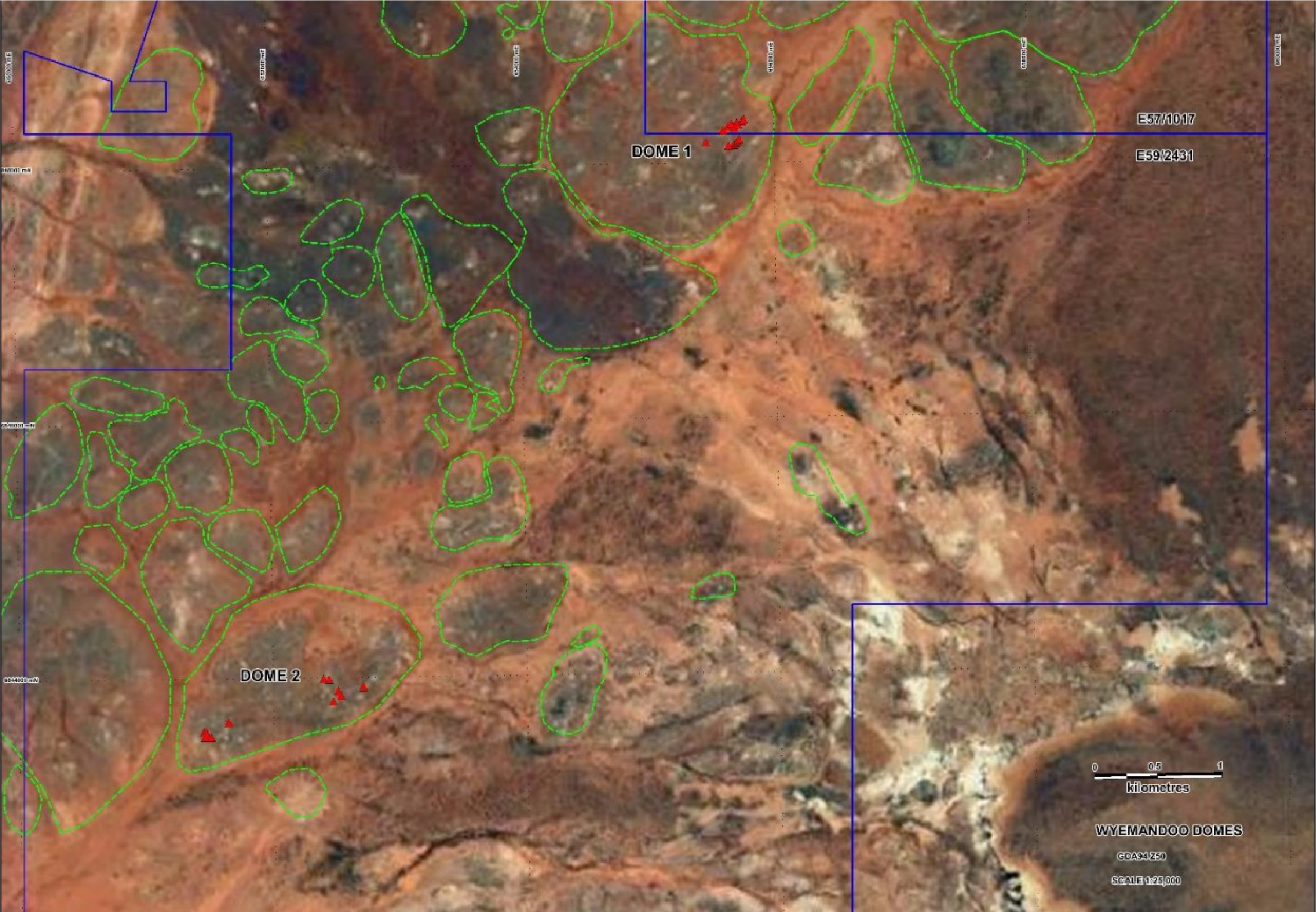
Rock chip sampling highlighted two priority Domes (1 & 2) for further investigation by RC drilling. At Dome 1 two loop structures (North and South) were interpreted as a flat lying sill passing through the two adjacent hills. Rock chip sampling around these produced anomalous lithium (up to 2.06% Li2O) and Rubidium (up to 1.7%). A nearby dyke also reported 2.6% Li2O from previous sampling. At Dome 2, pegmatites rock samples reported Li2O up to 2.32% and rubidium up to 1.24% with both flat lying sills and dykes interpretated across the NE trending dyke swarm.
As announced on ASX 4th May 2022, drilling commenced in May and by the end of this reporting period a total of 26 RC holes have been drilled totalling 3,286m and ranging from 82 to 202m in depth (ASX:23 June 2007). The majority of the holes have intersected pegmatites of various intervals from 82 to 202m in depth (ASX:23 June 2007). The majority of the holes have intersected pegmatites of various intervals from <1m to 6m with pegmatite-country rock zones up to 19m. The programme has been dictated by the pegmatite intersections where many have been interpretated as flat lying sills or moderately steeply dipping dykes orientated to the northwest.
Drilling concentrated in two areas, Dome 1 containing the two loop structures (Northern Loop and Southern Loop) and Dome 2 (approximately 5km southwest). The Dome 1 drilling found that the two loop structures were a continuation of a sill, up to 6m thick, which intruded what is now two adjacent hills surrounded by steeply inclined dykes dipping to the northwest and were possibly feeders to the local sills. At Dome 2 similar settings for the pegmatites were also noted with possible thicker sills interpreted.
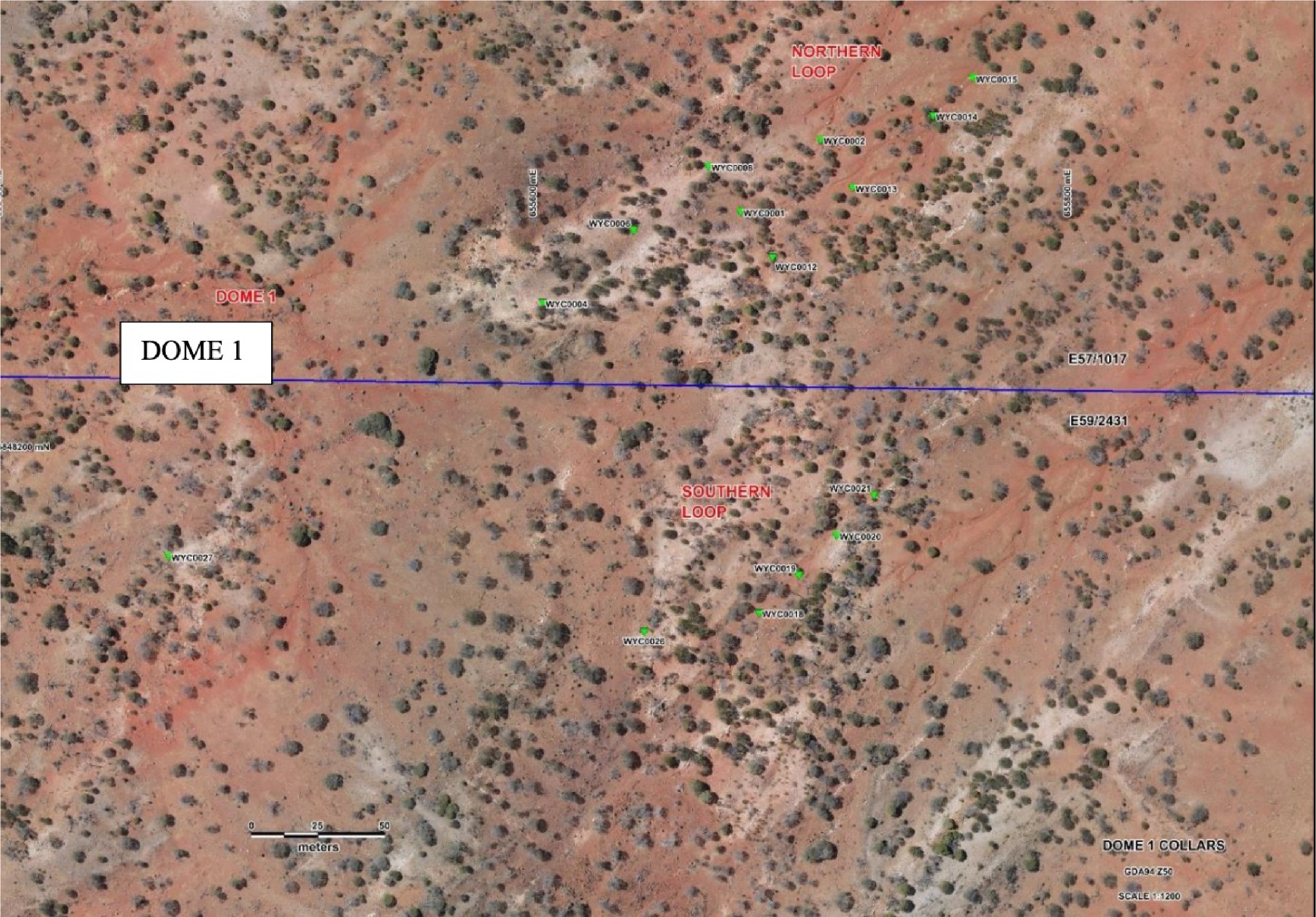
Figure 3: Dome 1 drill locations at the Northern and Southern Loops
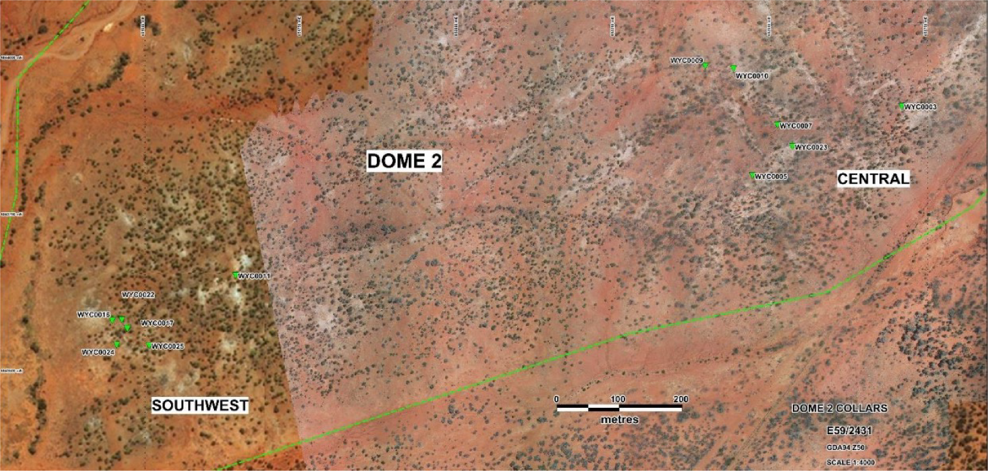
Figure 4: Dome 2 drill locations at the Central and Southwest targets
